Geotraces PMT GP 15

Departed: Seattle, Washington
Date: 18 September 2018
Arrived: Papeete, French Polynesia
Date: 24 November 2018
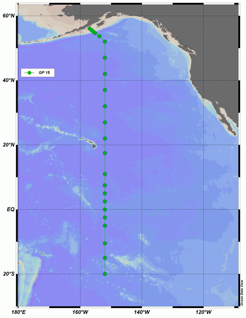
GEOTRACES is a global effort in the field of Chemical Oceanography in which the United States plays a major role. The goal of the GEOTRACES program is to understand the distributions of many elements and their isotopes in the ocean. Until quite recently, these elements could not be measured at a global scale. Understanding the distributions of these elements and isotopes will increase the understanding of processes that shape their distributions and also the processes that depend on these elements. For example, many “trace elements” (elements that are present in very low amounts) are also important for life, and their presence or absence can play a vital role in the population of marine ecosystems. This project will launch the next major U.S. GEOTRACES expedition in the Pacific Ocean between Alaska and Tahiti. The award made here would support all of the major infrastructure for this expedition, including the research vessel, the sampling equipment, and some of the core oceanographic measurements. This project will also support the personnel needed to lead the expedition and collect the samples.
This project would support the essential sampling operations and infrastructure for the U.S. GEOTRACES Pacific Meridional Transect along 152° W to support a large variety of individual science projects on trace element and isotope (TEI) biogeochemistry that will follow. Thus, the major objectives of this management proposal are: (1) plan and coordinate a 60 day research cruise in 2018; (2) obtain representative samples for a wide variety of TEIs using a conventional CTD/rosette, GEOTRACES Trace Element Sampling Systems, and in situ pumps; (3) acquire conventional CTD hydrographic data along with discrete samples for salinity, dissolved oxygen, algal pigments, and dissolved nutrients at micro- and nanomolar levels; (4) ensure that proper QA/QC protocols are followed and reported, as well as fulfilling all GEOTRACES intercalibration protocols; (5) prepare and deliver all hydrographic data to the GEOTRACES Data Assembly Centre (via the US BCO-DMO data center); and (6) coordinate all cruise communications between investigators, including preparation of a hydrographic report/publication. This project would also provide baseline measurements of TEIs in the Clarion-Clipperton fracture zone (~7.5°N-17°N, ~155°W-115°W) where large-scale deep sea mining is planned. Environmental impact assessments are underway in partnership with the mining industry, but the effect of mining activities on TEIs in the water column is one that could be uniquely assessed by the GEOTRACES community. In support of efforts to communicate the science to a wide audience the investigators will recruit an early career freelance science journalist with interests in marine science and oceanography to participate on the cruise and do public outreach, photography and/or videography, and social media from the ship, as well as to submit articles about the research to national media. The project would also support several graduate students.
