Public Projects

WindSite Virginia
I served as the user experience lead on this project. The goal of WindSite is to provide an effective solution for facilitating renewable energy growth in Virginia while mitigating impacts to military readiness. WindSite was developed as a holistic integrated tool for addressing the needs and effects associated with wind energy siting on operations, training, and research in the Commonwealth of Virginia. Coverage on Old Dominion University’s website and WVEC 13NewsNow (ABC affiliate) is available. Associated publications for this project are listed below.
- Allen, T. R., Richards, D. P., Whytlaw, J. L., McLeod, G., Cronin, J., Miles, J. J., Reiblich, J., Davis, C., & VanGraafeiland, K. (2022). A geospatial hub to support wind energy and maritime activity spaces near Hampton Roads, Virginia, U.S.A. Proceedings of OCEANS 2022, Hampton Roads, Oct. 17-20, pp. 1-5, doi.org/10.1109/OCEANS47191.2022.9976992
- Gonzales, L., Itchuaqiyaq, C. U., Kramer, C., Lindgren, C., Nur Cooley, S., Richards, D. P., Rose, E., & Sharp-Hoskins, K. (2022). UX in/as political re-negotiation (Extended Abstract). 2022 IEEE International Professional Communication Conference (ProComm), doi.org/10.1109/ProComm53155.2022.00089
- Richards, D. P., Whytlaw, J. L., Allen, T. R., Miles, J. J., McLeod, G., & Cronin, J. J. A. (2021). User experience design as a framework for political negotiation in environmental decision making about wind energy. In The 39th ACM International Conference on Design of Communication (SIGDOC ’21), October 12-14. Association for Computing Machinery, New York, NY, USA, pp. 231–239, doi.org/10.1145/3472714.3473646

Flood Risk Calculator
I developed and coded a flood insurance calculator using FEMA rates. It operates as a tool embedded within GetFloodFluent.org, a public education initiative led by the Hampton Roads Planning District Commission (HRPDC), with financial support coming from the Virginia Department of Conservation and Recreation’s Dam Safety, Flood Prevention and Protection Assistance Fund Grant Program. Media coverage on the site in general provided by NBC-affiliate TV WAVY-10. Coverage on the Old Dominion University website is also available. Associated publications for this project are listed below.
- Richards, D. P. (2023). Flood Insurance Rate maps as communicative sites of pragmatic environmental action. In S. Williams (Ed.), Technical communication for environmental action (pp. 95–120). SUNY Press.
- Richards, D. P., & Ball, D. K. (2020). Facilitating flood fluency: The design and utility of a flood risk calculator based on FEMA’s National Flood Insurance Program. In The 38th ACM International Conference on Design of Communication (SIGDOC ’20), October 5-9. Association for Computing Machinery, New York, NY, USA (10 pgs.), doi.org/10.1145/3380851.3416775

SLR Stories
Esri-based story mapping project juxtaposing NOAA’s Sea Level Rise Viewer with recorded stories of affected residents in Hampton Roads, Virginia and the Space Coast in Florida. This is a joint project between researchers at Old Dominion University and University of Central Florida, with financial support from SIGDOC’s Career Advancement Research Grant. The publications below cover the design and testing of the storymap.
- Richards, D. P., & Stephens, S. H. (2022). Do voices really make a difference? Investigating the value of local video narratives in risk perceptions and attitudes towards sea-level rise. Technical Communication, 69(4), 79–96.
- Stephens, S. H., & Richards, D. P. (2020). Story mapping and sea level rise: Listening to global risks at street level. Communication Design Quarterly, 8(1), 5–18.
Virginia Beach Flood Resilience Community Outreach
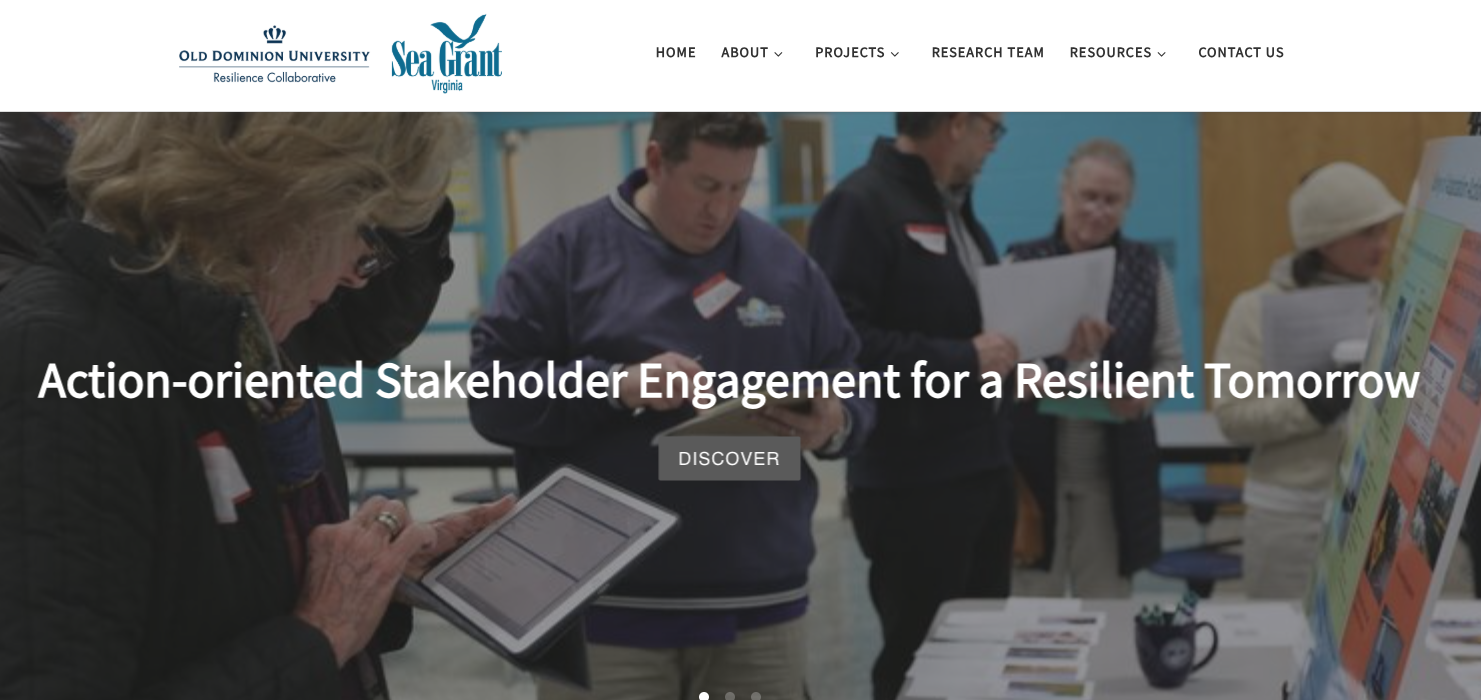
A research team at Old Dominion University has developed and tested the Action-Oriented Stakeholder Engagement for a Resilient Tomorrow (ASERT) framework as a participatory approach to engage stakeholders in adaptation actions related to flooding and sea level rise (SLR), most recently the Comprehensive Sea Level Rise and Recurrent Flooding Response Plan developed by the City of Virginia Beach. See media coverage done in part by ABC affiliate WVEC-TV 13 News Now. The associated publication for this project is listed below.
- Yusuf, J-E., Nicula, J. G., Richards, D. P., Agim, O., Covi, M., & Anuar, K. A. (2021). Engaging residents in policy and planning for sea level rise: Application of the Action-oriented Stakeholder Engagement for a Resilient Tomorrow (ASERT) framework. In J.-E. (Wie) Yusuf & B. St. John III (Eds.), Communicating climate change: Making environmental messaging accessible (pp. 36-57). Routledge, doi.org/10.4324/9781003037378
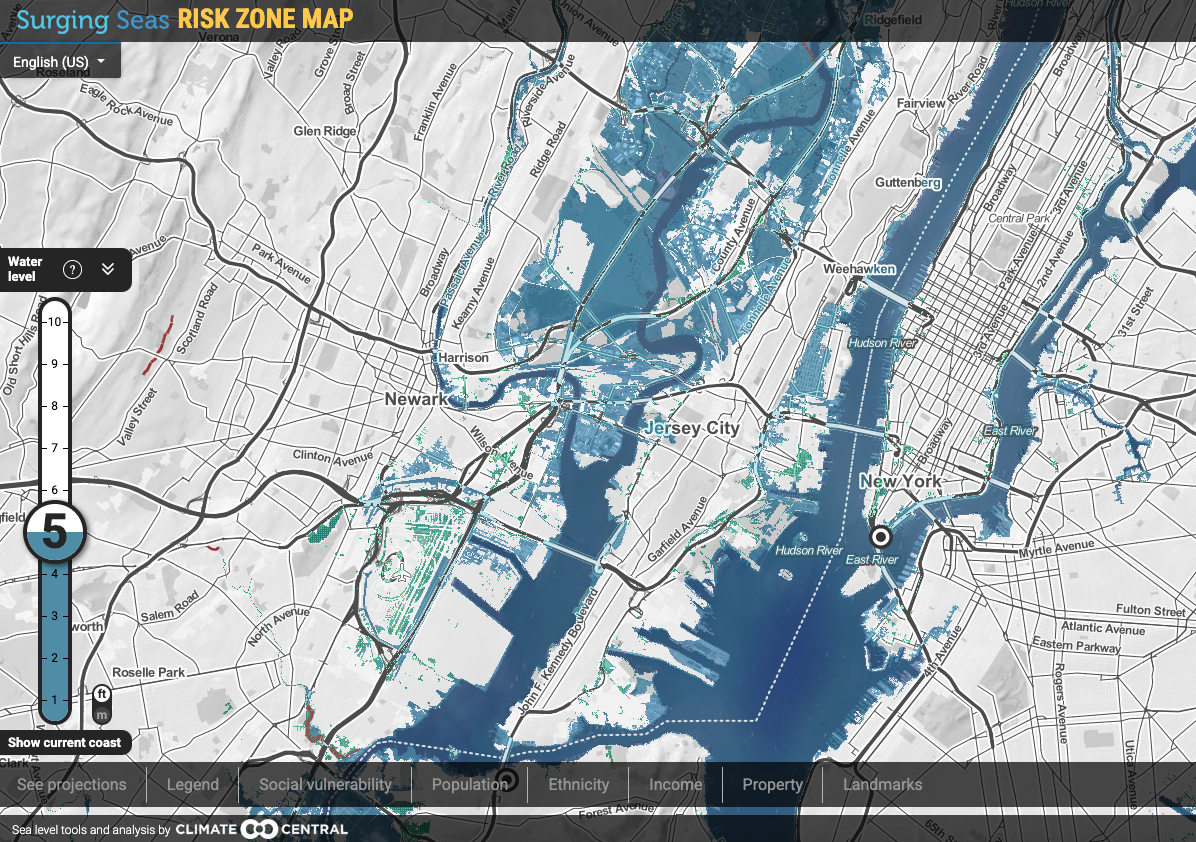
User Experience Testing on Climate Central’s Risk Zone Map
Conducted user testing on Climate Central’s Surging Seas: Risk Zone Map, which is a tool that allows users the opportunity to visually explore the extent to which sea level rise and other flooding events would affect their property and community. The results of the first round of testing were published in SIGDOC ’16: The 34th ACM International Conference on the Design of Communication Proceedings, and the second round results were published in the Journal of Business and Technical Communication. These and other associated publications for this project are listed below.
- Richards, D. P. (2019). An ethic of constraint: Citizens, sea-level rise viewers, and the limits of agency. Journal of Business and Technical Communication, 33(3), 292–337.
- Richards, D. P. (2018). Not a cape, but a life preserver: The importance of designer localization in interactive sea level rise viewers. Communication Design Quarterly, 6(2), 57–69.
- Richards, D. P. (2017). The challenges of exploring local place as a context of use in the study of interactive risk visualizations. In Proceedings of the 35th ACM International Conference on Design of Communication (SIGDOC ’17), August 11-13, Halifax, Nova Scotia, Canada. Association for Computing Machinery, 7 pgs., doi.org/10.1145/3121113.3121208
- Richards, D. P. (2016). Helping local residents make informed decisions with interactive risk visualization tools. In Proceedings of the 34th ACM International Conference on Design of Communication (SIGDOC ’16), September 23-24, Silver Spring, MD, USA. Association for Computing Machinery, New York, NY, USA, 6 pgs., doi.org/ 10.1145/2987592.2987626