
Welcome
Welcome to my ODU faculty website. Here I will post my professional research and teaching and share highlights for folks interested. Herein you’ll find highlights of my ongoing and recent research and teaching with ODU Geography and the Institute for Coastal Adaptation and Resilience (ICAR), which I serve as Program Head for Climate Science and Sea Level. I welcome you to check out either research or teaching pages here, and please reach out and contact me if you’re interested in collaborating.
This year I am working on a new course on applied Uncrewed Autonomous Systems (“Drones Seminar“), focusing on environmental mapping and coastal-marine problems. The seminar includes outside speakers, fundamentals of drone and autonomous surface vessels and applied projects. Last year I revamped the general education course GEOG 102T Digital Earth: Geospatial Technology and Society. The class introduces the full breadth of geospatial tech, digital globes, GIS, GPS/GNSS, remote sensing/earth observation, and spatial analysis. I’m adding some novel lab experiences for this class, including georeferencing a historic 1861 map of Hampton Roads and using spatial analysis for a Search for Sasquatch to demonstrate spatial thinking and ecological conservation. You can check out some visualization examples of this in my Hampton Roads Maritime Landscape story map. My current regular environmental course is GEOG 422W-522 Coastal Geography, focusing on coastal landscape ecology, geomorphology, and developing policy, planning and environmental management practices for sustainability. This course includes field trips in person and virtual field. One of the virtual field trips is here as an interactive story map Suffolk Scarp and Great Dismal Swamp tour.
I am continuing to offer and update two courses in upper-level advanced and graduate GIS, GEOG 420-520 Marine Geography: GIS for a Blue Planet, and GEOG 419-519 Spatial Analysis of Coastal Environments (SpACE). In collaboration with Esri, I’ve developed free lessons for Esri ArcGIS Pro for these courses, on topics such as visualizing seafloor geomorphology, analyzing climate change model forecasts for the oceans, sustainably siting aquaculture, and other GIS applications of environmental models, satellite and drone data. One example is the lesson, “Visualize an Ocean Canyon in 2D and 3D.”
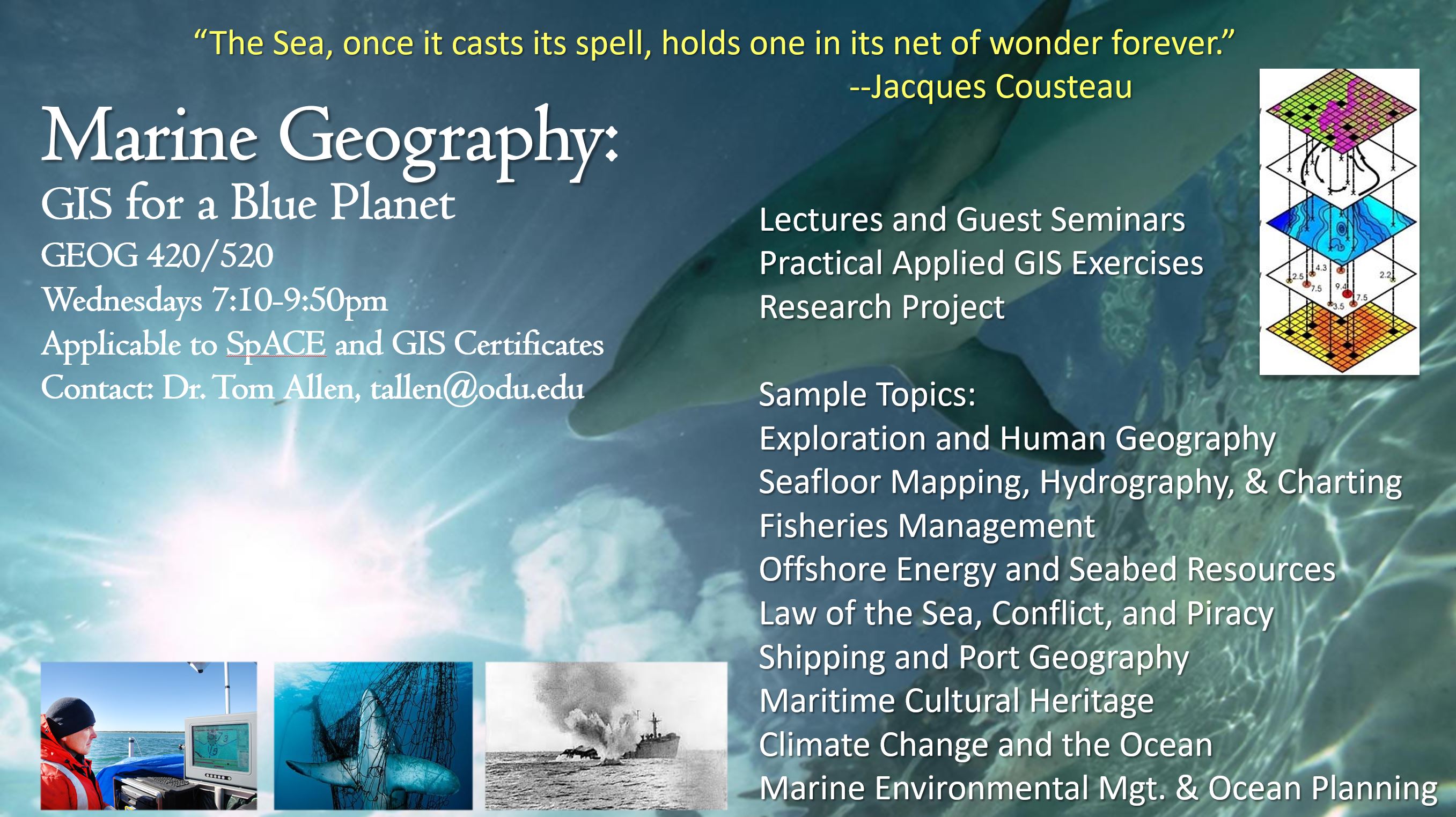
GEOG 420/520 Marine Geography
Marine GIS Story Map (“a 21st Century syllabus” https://arcg.is/01PXCD)
On the Surfliner train between San Diego and Oceanside, CA.
I returned to Old Dominion in summer 2016 after 10 years at East Carolina University. My research agenda and teaching continue in Geographic Information Science for coastal environments, hazards, and environmental resource sustainability. I participate in research as a faculty fellow with the Commonwealth Center for Recurrent Flooding Resiliency (CCRFR) and engage with communities in Hampton Roads, North Carolina coastal plain and Outer Banks and beyond tackling climate change, sea level rise, coastal hazards, and environmental challenges in sustainability.
If you’re a potential research collaborator, student, or stakeholder, please contact me by email: tallen@odu.edu